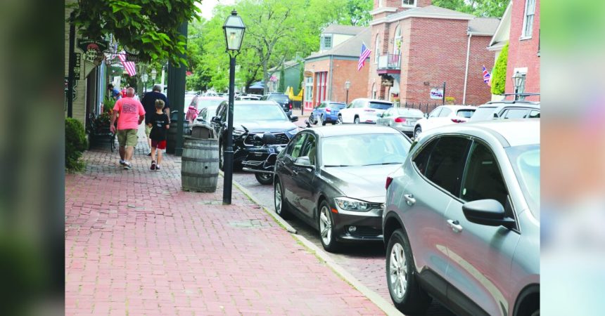
Parking has become easier in downtown St. Charles thanks to a new app, Park STC, which shows visitors where to find available slots.
A new app gives visitors to downtown St. Charles one less thing to worry about.
Whether it’s a bustling Friday night or the upcoming Festival of the Little Hills, Main Street and Frenchtown can get swarmed by visitors, making it tough to find parking. A new free app, Park STC, shows exactly where to find available spots in downtown St. Charles using smart parking technology. The app is available for Android and iOS devices.
According to Josh Hall, the Strategic Communications Manager of the City of Saint Charles, the public response has been terrific and that the app has been downloaded more than 3,000 times.
“The app has seemingly assisted visitors who are unfamiliar with Main Street, and assisted locals in discovering additional parking areas they might not have known about,” Hall said. “To further raise awareness the City will also be installing signs throughout Historic Main Street and to promote the app and provide information on how to download it.”
The app will surely come in hand in a few weeks when the Festival of the Little Hills takes place on Aug. 16-18. In its 54th year, the festival will once again stretch through Main Street, from Monroe St. to Boone’s Lick Rd., and throughout Frontier Park. The Festival of the Little Hills features 250 craft booths and 50 food and beverage vendors, including 27 new vendors, adding a new flavor to the event each year.
The app covers 30 blocks of downtown St. Charles, showing the status of approximately 1,500 parking spaces in real time.
“We took this on as a joint project with the City of St. Charles to help solve a problem for visitors and employees of businesses in the area,” Amanda Brauer, Managing Director of the St. Charles County Roads & Traffic Office, said. “The Main Street area is vital to the county’s tourism and economy. We hope this helps people who could spend a long time hunting for a parking spot, or turn away altogether.”
Sensors installed in the ground detect if a space is available or occupied, shown on the app as green if it’s a free space, or red if it’s taken.
“On street parking along Main is more of an estimate, since actual spaces are not marked,” Matt Seggerman, Project Manager for Roads & Traffic, said. “But you can get a fairly good read on if a green area is large enough for your specific vehicle, or at least be able to tell if it’s in a convenient area for you.”
The app does not require a user account (choose “Continue as Guest” when prompted on the home screen), and does not collect personal information if the user does not create an account, according to Seggerman.
“This is a tool used for other communities that have a variety of needs,” Seggerman said. “For those uses, extra information is needed, but for Park STC here in St. Charles, there’s no need to make an account.”
Smart parking is the latest implementation of the County’s Smart Infrastructure plan, using technology to enhance traffic and road safety projects in all parts of the county. In recent years, the Gateway Green Light program synchronized the timing of all traffic signals throughout the county to improve traffic flow. The Emergency Vehicle Preemption project coordinates traffic signals with first responder vehicles, prioritizing green lights for those vehicles and protecting the safety of others at those intersections.
“All these projects have a focus on preparing our infrastructure for growth,” Brauer said. “We have other projects that are in progress or awaiting the right funding that we hope will enhance safety and efficiency throughout the county.”
According to officials, the smart parking project cost about $800,000, with 80-percent of the funding from East-West Gateway Council of Governments, and the remaining portion split between the City of St. Charles and St. Charles County. This covers the implementation of the project, plus three years of data service. The outlook for the project includes expanding into additional areas of St. Charles as well as other municipalities where parking issues may exist. Another long-term improvement on the horizon is installing dynamic signs to help direct the public to parking areas. These signs would be updated in real time based on the sensor data.


